|
Day 1 - 22 June, 2012
- Salem, NJ to London, OH |
|
 |
| We hit the road about 9:30 with everything pretty
well tied down and ready to go. Melissa is a crafter,
and so brought along about 70 pounds of beads in small
trays. I have been camping and such since a Cub Scout,
so I was pretty much aware of what to expect on a long
journey like this. Our first stop was for gas about
seven miles from home. $3.21/9 per gallon.
We crossed
Delaware via the Delaware Memorial Bridge without
incident, navigating the familiar cloverleafs, left-hand
exits and other memorabilia of northern Delaware
roadway. Since the orange construction cone has been
adopted as the state tree, we were more than prepared
for any challenges I-95 might throw at us. The roadway,
once one leaves the suburbs of Wilmington behind, is
easily travelled, and while the scenery might not be
overwhelming, especially to a native, it made for a
relatively calm beginning. Wide swooping curves and very
slight up and downhill sections mark the road as it
nears the Susquehanna River crossing at Havre De Grace,
about 25 miles from Wilmington. |
|
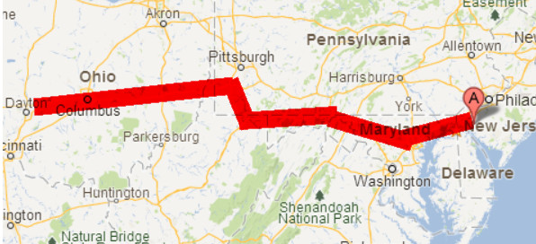
Tydings Bridge, I-95 over the Susquehanna |
| Passing exits for the Perry Point VA hospital and,
further along, the Aberdeen Proving Grounds, we soon
found ourselves in the outer limits of Baltimore,
keeping a watchful eye out for the exit to connect with
I-695, the Baltimore loop road that will head us
slightly northwesterly. Road construction at the
interchange, initiated during the administration of
Grover Cleveland, makes frequent high-speed lane changes
both frightening and requisite. Clever engineering
design also brings the new high-speed on-ramp of merging
traffic to bear on your right just about 50 feet before
the off-ramp for those wishing to exit over to I-695. I
never understood why a traffic engineer brings an ON
ramp along just before an OFF ramp. Be that was it may,
in a 10 ton traveling brick, one just sets the blinker
going, waits four complete milli-seconds, and fishtails
right. Anyone in the way, well, too bad.
Successfully,
if somewhat shakily, planted on I-695, it was now
nearing noon, and travelling on a summer Friday in the
Great Northeast Megalopolis, we understood the ancient
prohibitions. Traffic, I must admit, was not all that
hectic however, and once I simply accepted the fact that
moms in minivans would be swooping in and crossing my
bow with inches to spare on a regular basis, my blood
pressure returned to normal, and I concentrated on
missing the larger potholes, speed bumps, road debris,
and animal carcasses. This is the area of the Baltimore
bedroom communities like Towson, Bel Air and others -
huge tracts of housing development hidden just beyond
the sound-deadening walls of the interstate, each house
cunningly sculpted to look just like the one across the
street, individuality marked only by the different
colored sheds and outdoor accoutrements. It was amazing
what a seat about four feet higher than usual afforded
you when peering into roadside America.
Towson receded in our mirrors (not that we could SEE
anything in them, mind you, but I hear it was back there
a ways), and the rest of Baltimore's outer ring passed
by. Soon enough, we started seeing the signs for the
intersection with Interstate 70, our next leg, and our
pathway across the narrow neck of northern Maryland,
towards Frederick, Hagerstown and the Cumberland
mountains. It was nice to be driving across land that
offered some elevation change here and there. We
crossed up and over and down numerous low ridges, as the
Appalachians started to make their presence known. The
heat and haze made the scenery shimmer in a greenish
wave, and you could almost feel the humidity. In fact,
you could feel the humidity. It was 100%. Brief
summer showers are commonplace in the northeast, and the
rain sizzled and splattered on the windshield, briefly
washing away the hari-kari bugs. As quickly as it
started, it stopped. Then, steam began rising up from
the roadway, mixing with the ozone and unburned
hydrocarbons to make a somewhat glutinous miasma that
was at times difficult to see through.
Interstate 70 headed off to the north, finally
leaving the housing developments, transmission shops,
and fast food eateries behind. Traffic thinned out.
Melissa complained about the heat. Hal regaled us with
his tales of travel on this same road in blinding
snowstorms and sleet. It did little to cool us down.
Hagerstown seemed like a nice little place, what
little we could see of it. Now we were really getting
into the hills. On some long climbs, our speed dropped
to the 40s. They weren't steep, by any means, but were
long, long grades. This stretch of highway is
alternatively known as the "Great National Road", the
Eisenhower Highway, and the Cumberland Scenic Byway. By
any name, it was still a highway. Around Hancock, MD,
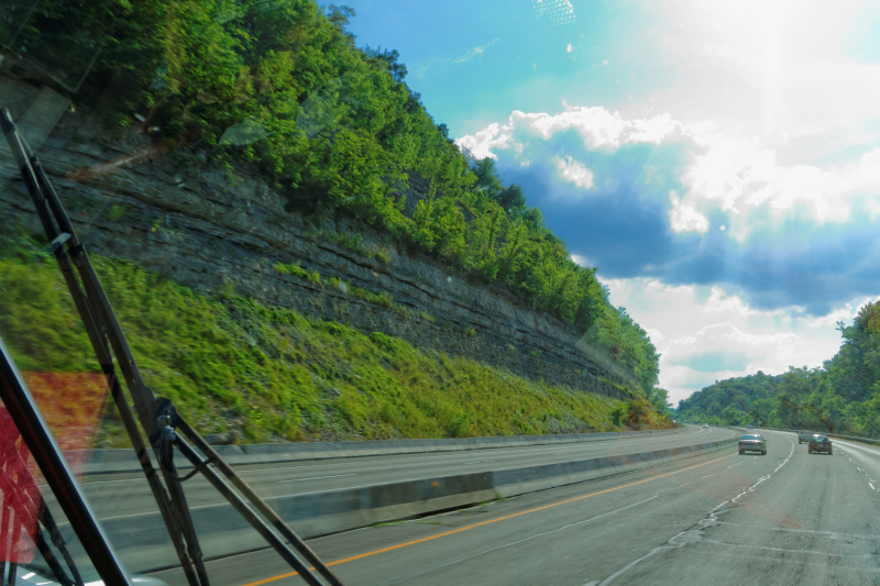
I-70 runs off north into PA, and I-68 heads west. The first real
excitement came just west of Hancock. Sideling
Hill is a long, narrow ridge of the Alleghenies that
runs from up in Pennsylvania all the way down in to
somewhere in Virginia. It's the first real big hill that
westward settlers had to drive their cattle over back in
the 1700s.
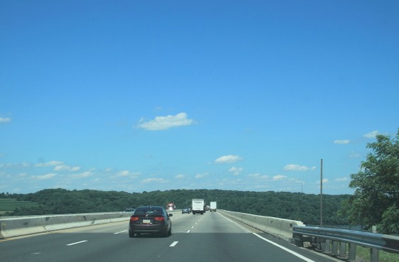
Up in Pennsylvania, there's a couple of turnpike
tunnels and a new road up and over the hill, and a railroad
tunnel or two through the mountain. But here in
Maryland, they don't fool around. They just cut a huge
chunk right out of the mountain, leaving an 800 foot
deep gash in dinosaur-laden Devonian rock, that's visible for miles
around. There's a pretty cool looking visitor center area
that was closed due to budget constraints, and a
pedestrian walk-bridge over the interstate for curious
gawkers. Unfortunately, the authorities frown on
stopping along the roadway itself to plumb for
fossils or anything interesting, so one has to speed by
the dig at 70 miles an hour. |
|
Sideling Hill Cut |
|
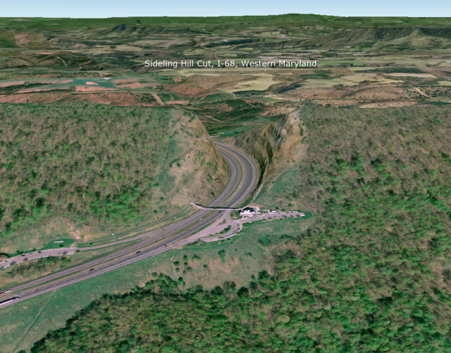
Google Earth View of Sideling Hill |
| Beyond the Cut, the road settles down
a bit, and the scenery, while calming, is not overly
dramatic. For someone who grew up on the East coast, and
is used to the gently rolling hills and unsurprising
geology of Pennsylvania, I was anxious to get out where
a 'mountain' was really a 'mountain'. To me, that
description didn't apply unless there is snow on
it in July. We trundled on, rolling
westward over the ridges that ran mostly north-south,
sometimes swerving around them, sometimes just following
the ribbon of concrete right up over the top.
Interstate 68 is co-aligned with US Highway 40 along
here, which was interesting since I'd lived along US 40
in a couple of different places in my lifetime.
I-68 was a major improvement over US 40 when it was laid
down over these hills, as 40 is a two-lane country road
with numerous switchbacks, hairpin turns, and steep
grades. Since 40 was laid down pretty much over
the old cow paths and native trails, there probably
wasn't much of an effort to make it easy for trucks,
busses and cars going 70 miles an hour. The late
1960s finally saw the construction of the interstate
over these hills, and the cities of Cumberland MD and
Morgantown WV saw improved traffic flow and, to some
extent, based on the number of billboards, an influx of
tourist/traveler dollars. One drops down out of
the hills into Cumberland. After a slight curve to the
right, you climb "Church Hill", a stretch of overpass
through Cumberland that offers at least a half-dozen
churches and ministries perched on a hilltop in the
center of town. |
|
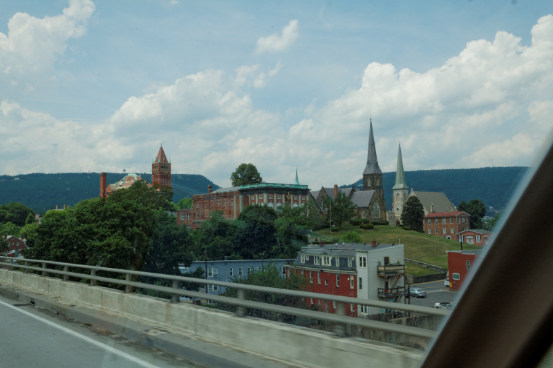
Church Hill, Cumberland MD |
| Out of town, you climb up Haystack
Mountain, all 1200 feet of her, and pausing for breath,
begin another roller coaster ride across the ridgeways
of western Maryland. After Cumberland, you pass beyond
or along the hamlets of Frostburg and Grantsville,
passing alarming close to the Pennsylvania border.
There isn't really much memorable here, but as I noted,
the scenery is verdant. And, of
course, there's the calming influence of the Wal-Mart
trucks everywhere you look. Around Grantsville,
you pass over a spot marked as the Eastern Continental
Divide, whereupon waters flow to the Atlantic on one
side, and the Gulf of Mexico on the other. More
interestingly, what it means is that every drop of water
you'll see from then until you cross the main Divide over
in Wyoming will drain into the Mississippi River at some
point. |
|
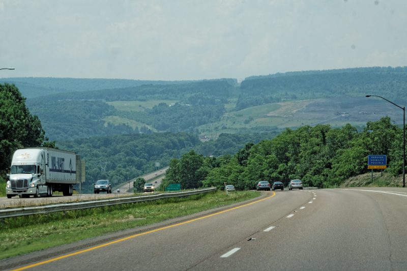
I-68 West of Cumberland, MD |
| A little farther along, we were
ascending Negro Mountain (I wonder if that's a 'cleaned
up' name?....) when another 30-second downpour hit, and
cleaned the bugs off the windshield again. It
didn't seem to drop the temperature or humidity much,
though. Before we knew it, we'd left Maryland behind,
and crossed into West Virginia at about 3PM, for the
first of two times we'd enter it today. |
|
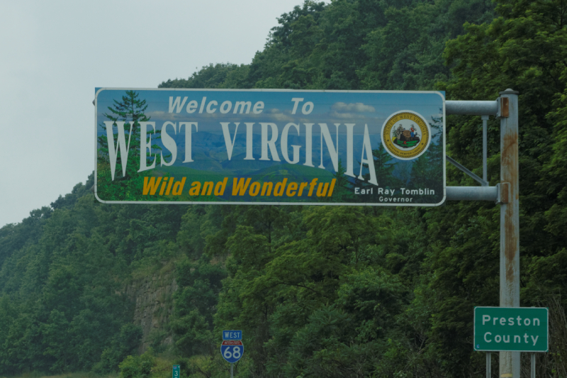 |
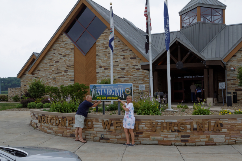
| The recent rains left fog and mist
settling into the hollows and valleys as we motored on
into Wild and Wonderful West Virginia. The border sign
reminded me that we were now entering the area where
everybody has three names. A few miles in, the
requisite state Welcome Center beckoned, and we pulled
off for our first break since Sideling Hill. We'd
decided to stop off at as many welcome centers as we
could, to collect post cards to send back home to our
grand daughter, and maps, brochures and
other touristy information to add to the archives. Hal
and Melissa pointed out to me that they were WILD and
WONDERFUL too... The University of West Virginia
was carrying out a survey on travelers, so I stopped
and gave them the kind of answers that would totally
skew their results, ("yeah, I was born here, this is my
first trip, there are 39 of us, heard about you in
geography class, but I probably won't be back")
and took a bottle of water as my door prize. |
|
 |
| About ten miles into West Virginia,
you come upon the Cheat Lake area. It wouldn't
have been all that memorable, but for the alarming
descent down to the water level, and the sudden and
abrupt left turn that the interstate took. Staying
straight, and not paying attention, would have landed us
in a very short downhill off ramp that ended quickly,
and bore the scars of not a few inattentive drivers.
Researching the local archives later on pointed out
numerous tractor-trailer and fuel truck roll overs, which
made being a volunteer fireman here a busy part-time
occupation. |
|
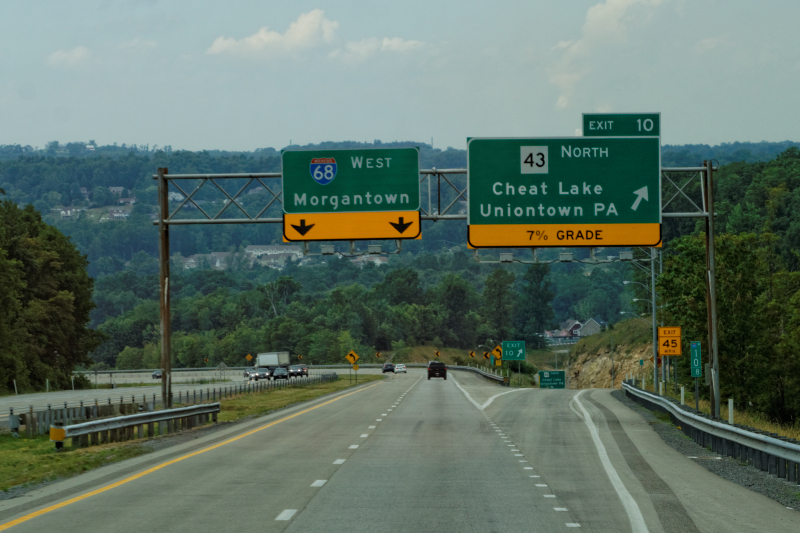
Cheat Lake exit ramp, check those brakes! |
| As Hal pointed out numerous times,
"if West Virginia was flattened out, it would be the
largest state in the country." And I believed him. It
was all rolling hills, curves, and bends, some of them
quite steep. When you consider that a 6% grade is the
design high limit throughout most of the US interstate
highway system, and here we were still virtually along
the Eastern Seaboard and already has gone up, down or
around almost a half-dozen 7% grades, it made one
appreciate the road building out west even more. The big
difference of course is not the grade itself, but how
LONG of a grade there is - these 6% and 7% slopes
in the east were maybe a mile, maybe two, in length
overall - out west, they went on for miles and miles.
When you've climbed a 14-mile 6% grade at 22 miles an
hour, you can definitely tell the difference.
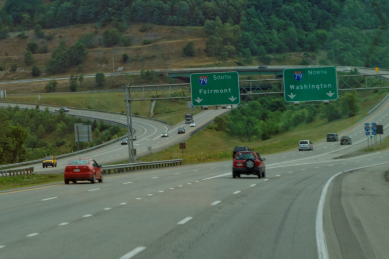
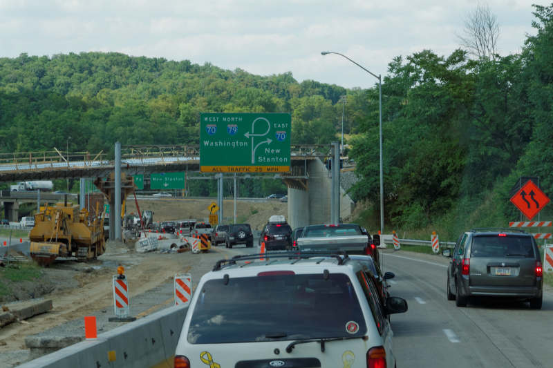
I-68 skirts Morgantown, WV to the south,
and just as you leave the town proper, our northern
route into Pennsylvania showed up. Interstate 79 would
take us up into PA, where we planned to hook up with our
major east-west route of Interstate 70. This would be
outside of Washington, PA, a spot where Northbound I-79,
the PA Turnpike, US 30, and I-70 all converged into a
construction zone.. We swerved right, and in just
a tick, crossed the Monongahela River.
|
|
Splitting, north to PA |
|
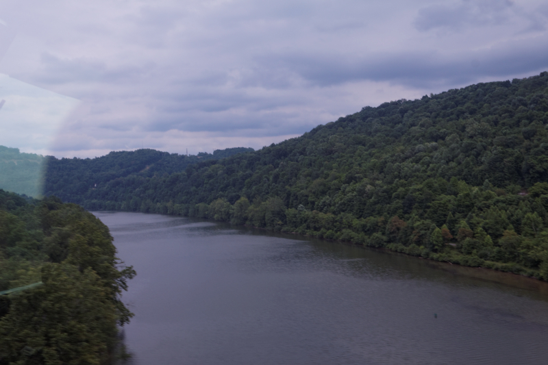
Over the Monongahela River |
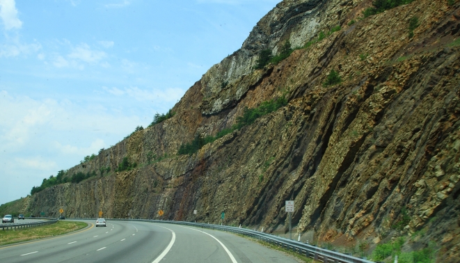
| Going north into Pennsylvania wasn't too much
different than going west across Maryland, but for the
fact that we were now traversing the ridges along their
top and sides, rather than going up and over them. This
led to somewhat different scenery, and I snapped a
couple of pix out the window as Hal drove. I have to
make a note to pull off the window tinting plastic along
the passenger window before the next trip - the eye
couldn't tell, but the blue really played havoc with the
camera's sensor recording bits and most of the pictures
I took out the side window were garishly miscolored.
It felt somewhat odd to be taking tourist pictures of
Pennsylvania, since I was born there and spend a huge
portion of my life there, but this was western
PA, and I was used to eastern PA. Not a huge
difference, just a little bit hillier. |
|
Western Pennsylvania Scenery |
|
We hit Washington, PA
about 4:30 in the afternoon on a Friday. Perfect timing.
No more needs to be said. |
|
I-70, I-79 meet in Washington, PA |
| Sooner or later, though, we made our
270-degree turn to the west, merged on to I-70,
and proceeded apace, heading towards the north-south
panhandle of West Virginia, and the border crossing at
Wheeling. I will always remember "Wheeling, West
Virginia" because as a youngster I had a book called
"The Child's Geography of the World" or some such, and
there was a picture in it of a kid with a wheelbarrow,
pushing a big outlined state of West Virginia, with a
caption that read "Billy has a hard job WHEELING WEST
VIRGINIA!" Just as we approached the border
sign, I noticed a state cop had stopped someone. I
wonder if they sat in their car and thought, "Damn.
Another hundred yards and I'd have gotten away..." |
|
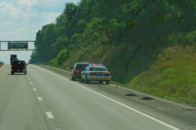
A run for the Border |
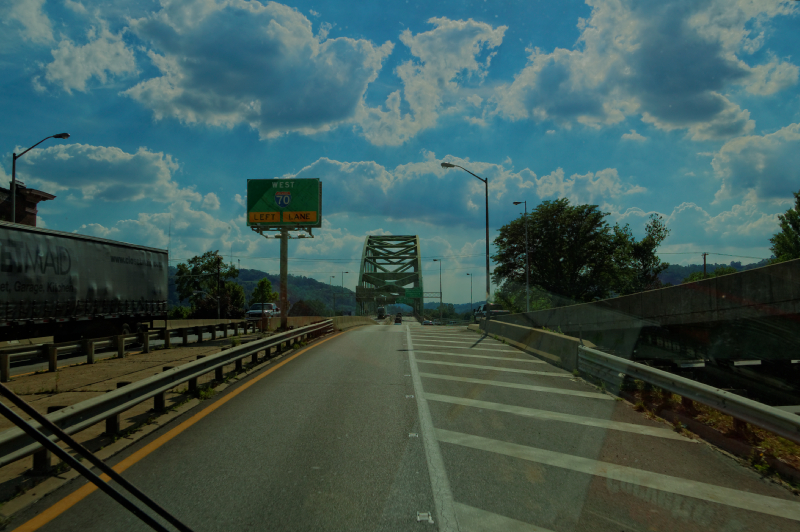
| Once over the border, there's not a
whole hell of a lot of West Virginia before you come
into Wheeling. There's a spot where I-70 goes through a
short tunnel before it comes out and crosses one of
about 87 bridges across the Ohio here. Sorry
about the reflections but there's not much you can do
when shooting through a windshield the size of a dinner
table. |
|
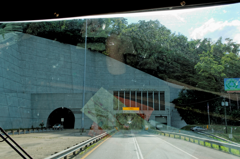
Wheeling Tunnel |
|
 |
|
Hal leaned back to afford
me a shot down river. |
|
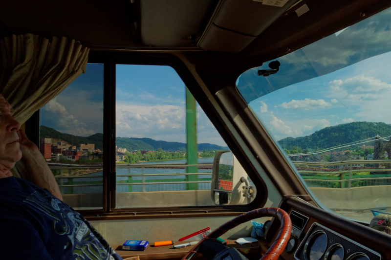 |
| But they fooled us! We came out onto
an island in the middle of the river, so there's another
bridge before you can say "A Child's Geography of the
World". |
|
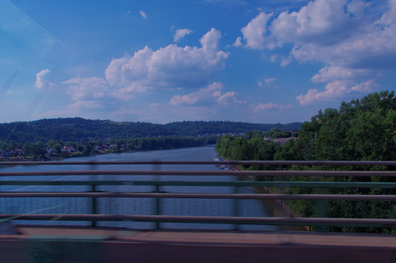
Over the Ohio River |
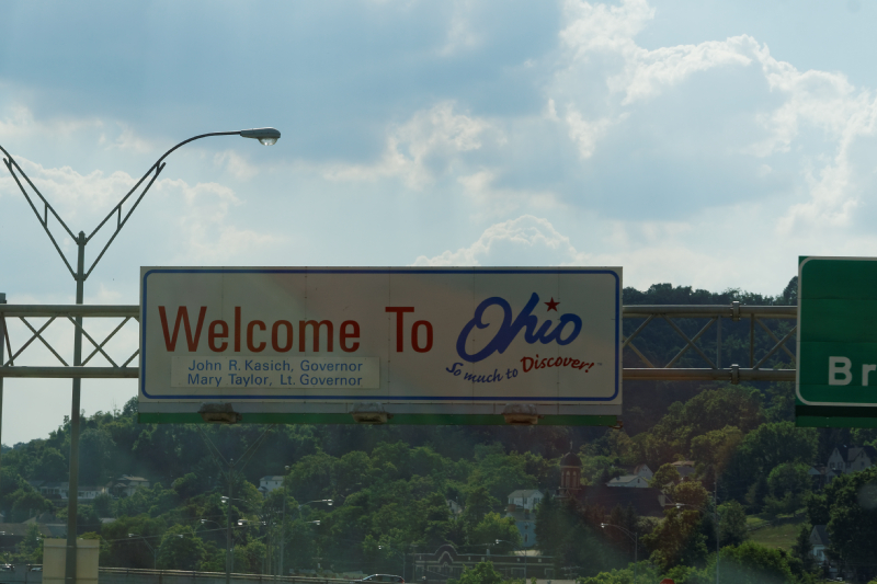
| Once back over solid ground, we were
in Ohio. It was our SIXTH border crossing of the
day, and it was barely 6PM. Very sunny in Ohio, as we
seemed to have moved west past the line of damp
thunderstormy weather we'd been in off and on since
around Baltimore. Ohio was a continuation,
geography-wise, of Pennsylvania, Maryland and West
Virginia. They even tried to take a page out of
Maryland's book at one point along I-70, but it just
didn't work. |
|
 |
|
 |
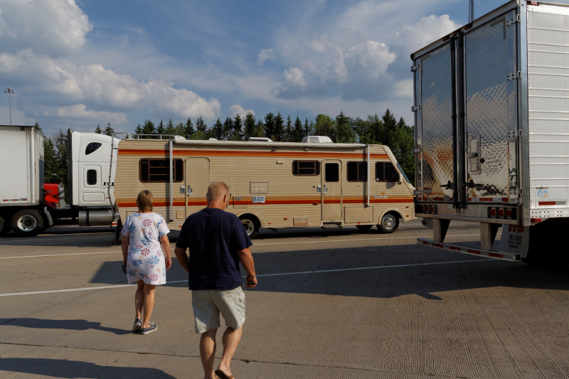
| The Ohio Welcome Center was so
un-memorable that I didn't even take a picture of it.
Melissa, Hal and I walked back to the Bounder. |
|
 |
| Just after the WC, we hit what would
be our only major snag of the whole trip. There was
construction west of us, around the city of Cambridge,
Ohio, where the East-West I-70 route interchanged with
the north-south I-77, and for some reason, Ohio DOT
thought it best to work on the offramps that led traffic
off of I-70 onto I-77 during a Friday afternoon in the
summer. About ten miles east of the interchange,
traffic came to a complete standstill. No, not a slow
move here and there for a couple of feet. A complete
standstill. Minutes passed. More minutes passed.
The only movement was when westbound cars humped and
bumped over the median between lanes and turned east to
head back to the nearest exit. Then the rest of us
hardy souls moved up one car-length at a time. After
nearly two hours, it was getting ridiculous. I
entertained notions that the entire roadway must have
disappeared into a sinkhole up ahead, as there was no
east bound traffic on the other side either. Finally, I
got up the nerve, at a relatively smooth spot in the
median, to haul the Bounder around, and head back
towards Wheeling. We took the first exit we could and
looked for west bound US 40, which we had of course been
paralleling most of the way. It was a little two-lane
road here, but we took it the few miles into Cambridge,
and stopped for gas, our first fill up of the trip.
Interestingly, my Brand New Pilot card wouldn't work,
because I foolishly neglected to authorize and turn it
on before we left. We called Pilot's customer support,
and of course, the conversation went something like
this: ME: "I need to authorize
my Pilot card so I can pay for the $150 bucks worth of
gas I just pumped."
Pilot Customer Service: "Sure, no problem. What's the
number on the card?"
I read it to him.
Pilot: "OK, now the authorization number on the back?"
I gave it to him.
Pilot: "Very good. Now, what's the user PIN code we sent
you in an email to authorize the card?"
Me: "um.....I haven't the faintest idea. The email is
home, on my computer, about 500 miles east of here."
Pilot: "Hmmm. Well, we can't authorize the card without
that PIN."
Me: "But you KNOW it's me here. I gave you my Social
Security number, my zip code, read the card number and
authorization code to you, and even answered all
your dumb security questions."
Pilot: "Yes, but we need that PIN code. We can send it
to you again."
Me: "Great. I'll get it in two weeks when we get home."
Pilot: "When you get the PIN, call us back and we'll
authorize the card."
Needless to say, we went on like that for about another
20 minutes, to the great amusement of the clerk waiting
for his $150 and the line of cars now breathing heavily
down my neck behind the Bounder. Pilot wouldn't
turn the card on, no way no how, without that PIN
number. So after a while we managed to back out the
charge on the Pilot card and charge it to another gas
card. There was nothing left to do now but go have
dinner at a nearby Cracker Barrel, and head back west.
After speaking with the locals, it seemed that they'd
learned to live with the fact that the major North-South
and East-West thruways in their city were completely
closed off for normal vehicle traffic every evening from
3:30 PM until about 4AM in the morning. We took US 40
for another six or seven miles until we could safely
re-join I-70. By now it was dark. We blew past the old
speedtraps of Zanesville, and after an hour or so came
upon Columbus. The capitol of Ohio had been my
first-night destination, and within a few minutes of
leaving it in our mirrors, we found a large Flying
J/Pilot truck stop that we knew we could stay at for
free, and perhaps give me a chance to work something out
with a live Pilot person. We soon realized that spending
the night amid about a hundred idling diesels is not
really good for the sleep, so we drove out around front,
and parked there. It was an uneventful stop. Our first
day had been fairly easy, except for the slowdowns in PA
and Ohio. Total Mileage on Day 1 : 535 |
|
Intro |
|
Day 2 |
|
|